
Proprietary Aviation Software & AI Systems Engineering
Pioneering native delta river management software, centimeter-accurate riverbank drone photogrammetry, and next-generation AI flight control systems integrated with high-fidelity digital twin simulators.
Proprietary Aviation Software & AI Systems Engineering
Pioneering native delta river management software, centimeter-accurate riverbank drone photogrammetry, and next-generation AI flight control systems integrated with high-fidelity digital twin simulators.
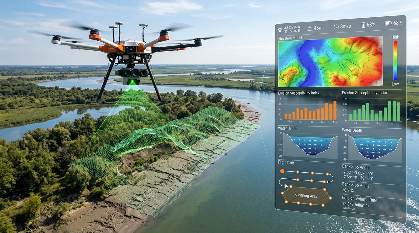
Proprietary River Management Software & Drone Riverbank Mapping
Engineered specifically for Bangladesh’s complex delta topography, our proprietary River Management Software (RMS) integrates automated UAV flight plans, bathymetric point-cloud datasets, and multispectral drone photogrammetry. The system generates high-accuracy digital elevation models (DEM) of dynamic riverbanks, predicts volumetric soil displacement, and enables early erosion hazard warnings for riverine communities along the Padma, Jamuna, and Meghna rivers.

AI Systems Design, Flight Software Integration & Simulation
Our aerospace engineering lab designs edge-compute artificial intelligence architectures directly embedded into UAV flight controllers. By integrating deep neural network vision models with custom-compiled flight management software (PX4 & ArduPilot stacks), our drones achieve autonomous obstacle avoidance, precision target tracking, and GPS-denied optical flow navigation. Every software release undergoes rigorous Hardware-in-the-Loop (HIL) simulation testbench validation across severe wind shear, turbulence, and sensor failover scenarios before deployment.
Core Aerospace Innovation Focus
Four specialized technical clusters driving native aviation sovereignty and aerospace capabilities in Bangladesh.
Embedded Edge AI & Avionics
Ultra-low latency deep learning computer vision embedded on carrier companion boards for onboard hazard avoidance, real-time target tracking, and autonomous waypoint rerouting.
Hydrological GIS & Bathymetry
Multi-spectral aerial sensing, sub-centimeter point clouds, and automated volumetric displacement calculation tailored for delta riverbank stability and flood embankment defense.
Hardware-in-the-Loop (HIL) Sim
Digital twin flight dynamics simulation replicating dynamic delta monsoon wind shear, gust envelopes, and sensor dropouts on real flight controller hardware.
Indigenous Airframe Optimization
Aerodynamic computational fluid dynamics (CFD) modeling tailored for long-endurance tropical surveillance, high payload delivery, and localized severe weather resistance.
Development Lifecycle & Milestone Pipeline
Tracking proprietary system validation from testbench formulation to operational airspace deployment.
High-Precision Aerial Surveying & DEM Calibration
Calibrated sub-2.5cm accuracy contour generation across active riverbanks along Padma and Jamuna river basins with ground control points (GCP).
River Management Software (RMS) Predictive Modeling
Volumetric soil displacement differential algorithms, automated shoreline erosion detection, and GIS telemetry integration with disaster authorities.
HIL Digital Twin & Embedded Neural Flight Control
Custom PX4/MAVLink flight control stack integration with embedded edge TPU inferencing under 15ms latency and sensor failover injection.
Autonomous Beyond Visual Line of Sight (BVLOS) Field Trials
Full autonomous riverine surveillance corridor validation and automated emergency return-to-base protocols under CAAB civil air regulations.
Collaborate with the BAI Aerospace R&D Wing
We actively partner with government departments, water resource authorities, disaster management agencies, universities, and international aerospace labs on collaborative research, testing, and technology transfer.